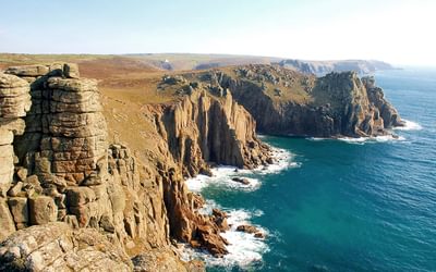
The Making of the Jurassic Coast

Enjoyed Jurassic Park? Want to see a slightly more realistic representation of geology and paleontology? Then head to the Jurassic Coast - with a little insight from Ronald Turnbull's guidebook you will find the landscape tells an equally (if not more) gripping story. Plus, the icecream is cheaper than at the cinema.
The insight that starts off geology – Aristotle wondered about it, and so did Leonardo da Vinci – is that rocks such as sandstone really are the remains of other earlier rocks, broken down and recycled over immense periods of time. What breaks them down can be rain or wind, streams or rivers, or even ice. But the main sand-maker is the sea. Almost all of the rocks of the Jurassic Coast are ‘sedimentary’. There are no igneous rocks, arriving red hot and fresh from volcanoes or congealing deep underground. There are no metamorphic ones, cooked and mangled by mountain-building. What we see are sandstones, which are made of sand, and limestones, directly dumped on the sea bed by chemical precipitation.
When we look at a rock, what we want to know is: where did it come from, how was it made? How convenient, then, that every coastal walk has cliff face exposures and beautifully polished pebbles. But also, working away right here in the present day, the same geological earth force that made the limestone and sandstone in the first place – the sea.
The sea nibbles into the land along a narrow band between the high and the low tide lines: it’s like a strimmer slicing into a tangle of weeds.
The sea nibbles into the land along a narrow band between the high and the low tide lines: it’s like a strimmer slicing into a tangle of weeds. And so at low tide the shoreline often shows a wave-cut platform; rock beds cut off almost flat, between the minus 10m contour and the zero one, the only zone where the waves can actually attack.
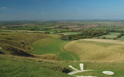
At the cliff base, the waves start by grinding out a notch. It’s sand and small pebbles that act as the abrasive. When the cliff is sufficiently undercut, down it comes. The rubble on the beach protects the cliff face for a time. But straight away the finer dust and sand are carried away: from above you see them staining the sea. The smaller pebbles go next. A century later, only an arc of big sea boulders, seen from the cliff top above (see Walk 10), marks the site of a former cliff collapse.
Wherever a faultline has already weakened the rockface, the waves cut inwards: and now a new and surprising cave-making agent takes over. Sand-scrubbing isn’t effective within a hollow. Instead, the incoming wave compresses air within the cracks of the rock. As the wave sucks, the air expands, almost explosively, driving the rock apart.
And so a small hollow becomes a big hole – look in the roof of any sea cave and you should see the faultline that provided the initial point of weakness. Where a faultline passes right through a headland, sea-caves at either end join to become an arch. The arch collapses to form a sea stack. Wave action attacks the base of the stack; it falls; and the sea moves on inland.
Will this process of sea erosion, given time, eventually erase the whole of England? We know it will – because it already did!
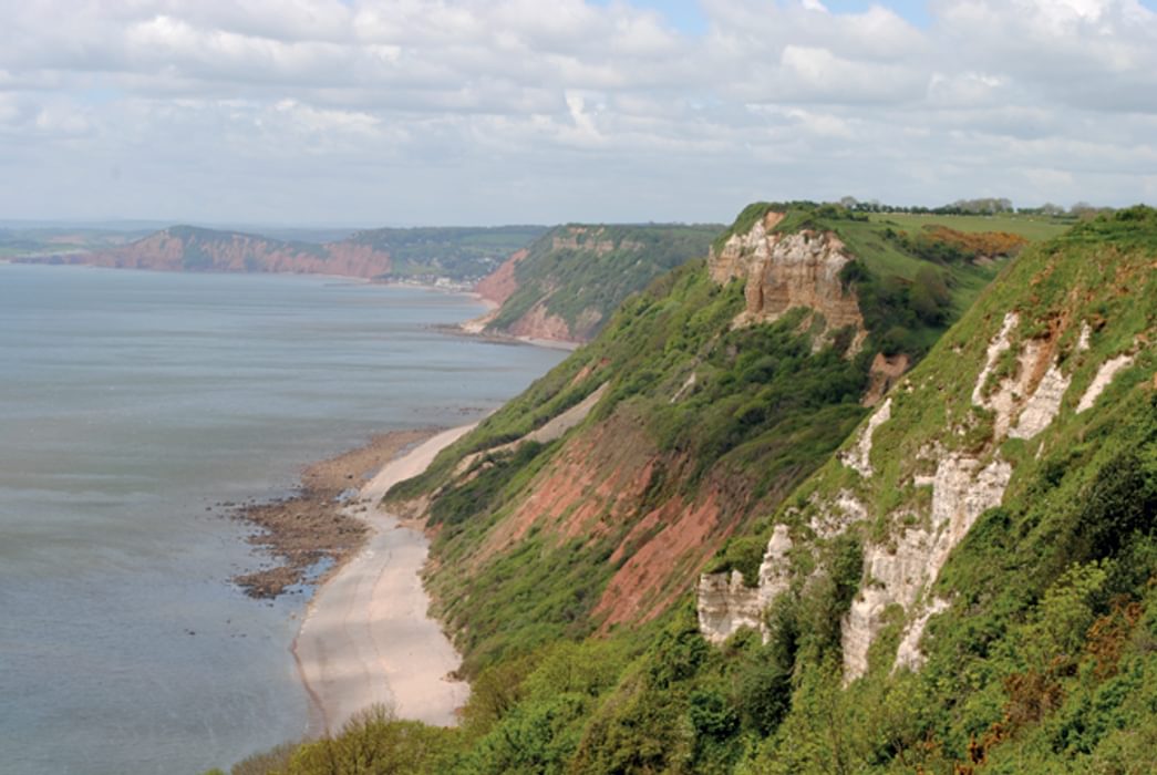
Will this process of sea erosion, given time, eventually erase the whole of England? We know it will – because it already did! In the Cretaceous (the Chalk time), a soupy, algae-infested sea carved its way right across an old content of red sandstone and layered limestone. Along 50 miles of the Jurassic Coast, between Budleigh Salterton and White Nothe, the Greensand and Chalk which were the bed of that soupy sea slice clean across the older beds, chopping off the tops of the older (Triassic and Jurassic) rocks. At any one place (Golden Cap, say) it just looks as if the Chalk sits on top of other rocks in the ordinary way. It’s over several walks, or in the cliff diagram at the back of this book, that you appreciate that the Chalk doesn’t just sit on the earlier rocks, but actually cuts across them.
An unconformity is where one rock sits on the eroded down remains of an earlier one, implying a time-gap of missing rocks between. The unconformity at the base of the Chalk Sea can be traced from Hampshire to Devon: it’s known as the Great Unconformity.
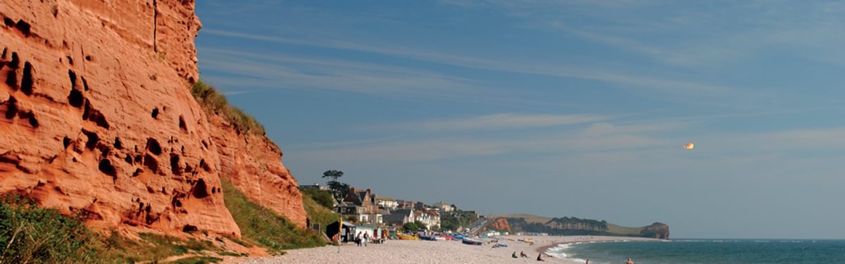
Geology started in England – specifically in the Jurassic limestones and sandstones around Bath. Around 1795 a surveyor called William Smith, with access to coal mines and canals, began to make sense of what was what and in what order. And the first thing was several major layers of stone that happened all over the place. The Chalk stretches from Beer and Old Harry Rocks by way of the Wiltshire Downs to the coast of Yorkshire. The New Red Sandstone, as seen all along the Devon end of the Jurassic Coast, is seen again in Cheshire, and under Nottingham Castle. And underneath the New Red is where you come across the coal.
The Universal Formations are not in fact worldwide. But the Coal Measures, the New Red Sandstone and the Lias are big, recognisable slabs of stone that do indeed reach a long way sideways. The NRS is identified from North Africa to Greenland. Nature wanted to make it easy for those first geologists. Straight away they could start to work out what was what – in a way that was useful, too. If Lord Egremont’s land was the Old Red Sandstone, there was no point at all in Lord Egremont digging into it in the hope of coal: the Coal Measures lie on top of the Old Red.
Modern geology has abandoned these ancient classifications. But for beginners, whether in the 18th century or today, they’re jolly useful. The Jurassic Coast involves the New Red Sandstone in the west, the Lias of Lyme Regis (and also of north Somerset, Glamorgan, and Yorkshire), and, of course, the Chalk.
When it comes to the detail, Nature again goes out of her way to be helpful. Sedimentary layers, such as those of the Jurassic Coast, contain the remains of the creatures that lived in them. God clearly wants geologists: fossils are preserved in half a dozen different ways.
Calcite – the mineral that forms most seashells – is itself extremely persistent and can survive for 200 million years embedded in the sand. Alternatively, the original mineral (fishbone, say) can be replaced, an atom at a time, with a rock mineral such as golden-black pyrites. Sometimes the rocks preserve the hole where a fossil was: this could be a shrimp burrow, or it could be the footprint of a dinosaur. Pure carbon is as persistent as calcite; and around Lulworth you’ll see bits of trees turned into smears of coal. More exotic forms of preservation – amber, opal – are very rare, but can save quick-rotting insects in the minutest detail.
And so, for all the component layers within, say, the Lias, William Smith was able to work out three very useful principles (see below). Using these principles, today’s geologists identify 71 different rock layers at Lyme Regis, each with a slightly different ammonite. And us amateurs can do the same thing on a larger scale. Find ammonites, and you’re probably in the Jurassic – though they didn’t become completely extinct until the end of the Cretaceous (chalk) period. The giant ammonites (Titanites) put you at the very top of the Jurassic, in the Portland Stone. The ‘Portland Screw’ puts you even more precisely in the Portland Stone’s top layer. The bent oysters nicknamed the Devil’s Toenails only lie in the Lias. And right outside the Coastal Heritage Centre at Charmouth, a beautiful rugose coral puts you firmly in the Carboniferous Period – yes, someone’s been building sea defences out of a Wrong Sort of Rock.
Along the Jurassic Coast, you will find fossils. What you won’t find are giant reptiles and fish, or the beautiful round ammonites you see in museums. They’re in museums precisely because they’re rare and wonderful. What you will find – and what I’ve mostly tried to show you in this book – are broken bits, stuff that’s been washed over by the sea, plus plenty of seashells, and (once you’ve got your eye in) worm burrows and algal slime. Your first ammonite could take ten minutes, or it could take ten days. It’s a thrilling moment either way.

Walking the Jurassic Coast
Dorset and East Devon: The walks, the rocks, the fossils
£14.95
This guidebook includes 30 walks on the Jurassic Coast of Devon and Dorset. Covering the coast between Exmouth and Bournemouth, these delightful routes range from 3 to 16 miles (5 to 24km), exploring and explaining the spectacular geology of this World Heritage area with clear, easily understood descriptions, cross-sections and timelines.
More informationYour chances are better away from car parks and people. They’re better at dawn after an overnight high tide; in autumn and winter; and especially after a winter storm. There’s no need to carry a hammer – over much of this coast, hammering for fossils is illegal. A magnifying glass can help, but the best bits of equipment are feet and eyeballs. Look at clean, sea-washed boulders; also at shaly, friable sort of rock, especially where it’s freshly broken open. Glance along the pebbles turned over by the latest high tide. Recent cliff falls are tempting, but they are also dangerous. If sitting down, sift through some shingle or sand with your fingers. And life of 250 million years ago is all around you.
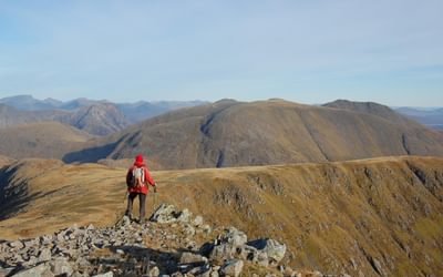
You can't get more dramatic than that.
To read more articles like this get our newsletter
Sign up for 20% off your next purchase and to be the first to hear about exclusive competitions, special offers, and news from Cicerone.