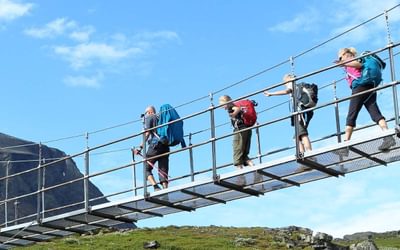
Walking the Peaks of the Balkans Trail
The Peaks of the Balkans is a cross-border long-distance trail through the spectacularly wild and rugged borderlands of Montenegro, Albania and Kosovo.
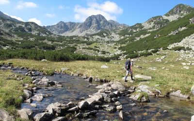
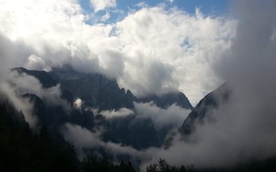
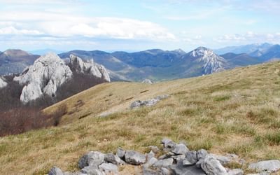
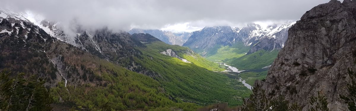
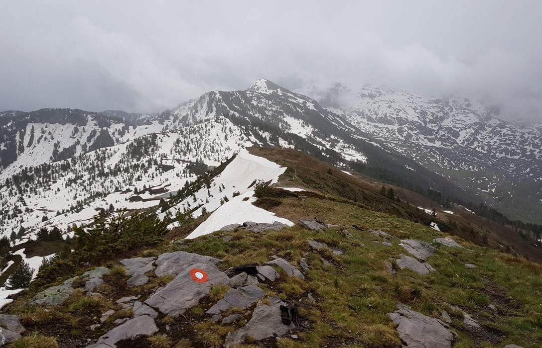
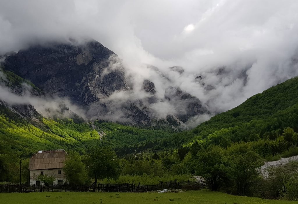
A circular route of around 192km in length, it takes in remote valleys, lakes and mountain passes, winding its way through some stupendous mountain scenery and passing through traditional mountain villages which often feel like somewhere time forgot. It’s a corner of Europe few people are familiar with, let alone visit.
Since it’s a circular route, there are several points at which you can choose to start and finish hiking the Trail and there are two points where the ‘circuit’ meets, like a figure of eight.
Starting from the village of Theth in Albania, the route crosses a pass to reach the Valbona Valley, and climbs to the Montenegrin border below Maja Kolata, one of the highest peaks in the area, before descending to the tiny settlement of Çeremi. Later it passes through the remote summer settlement of Dobërdol before crossing the border into Kosovo, and descends to the Rugova Gorge. Crossing into Montenegro it passes through Babino polje then climbs to Lake Hrid, before descending to the town of Plav and, after crossing Vrh Bora, to the village of Vusanje, before following the Ropojana valley up into Albania again, crossing the Pëjë Pass and descending to Theth.

The Peaks of the Balkans Trail
Montenegro, Albania and Kosovo
£18.95
Guidebook to the Peaks of the Balkans Trail, a 192km trek through Montenegro, Albania and Kosovo. The route, which can comfortably be completed in less than a fortnight, is waymarked and covers terrain between 670m and 2300m in altitude, taking in remote valleys, dramatic mountain passes, stunning scenery and villages untouched by time.
More informationThe trail is well marked for much of its length, a reasonably good map is available covering the whole route, and access is relatively straightforward – sometimes extremely straightforward – to several points along the way by local buses. Good, knowledgeable local guides are available to accompany groups or individuals along the route. Hiking is along existing paths and 4WD tracks and is not technically difficult – however the surrounding mountains are high and the weather can change suddenly and dramatically, and for the most part the route is very remote. Exit points, should you need to break your trek short in an emergency, may be several days apart, and may not be in the country you arrived in.
It’s possible to start and finish the Peaks of the Balkans in any of the three countries through which it passes, however whichever starting point you decide on, you’ll need to obtain a cross-border permit from the relevant authorities in Montenegro, Albania or Kosovo before setting off and actually walking the trail. Judging by the helpful and informative Peaks of the Balkans website, you would be forgiven for thinking this should be easy enough to do yourself, but in fact it’s not quite as straightforward as you might expect, and it is worth simply getting a local agency to sort out the permit.
When to walk the Peaks of the Balkans Trail
The hiking season begins in May or June, with the latter bringing more settled weather and milder temperatures – although you can still expect snow patches in June, or until July in higher areas. Wildflowers are at their most spectacular in June. July is statistically the driest month, followed by August and June – but this doesn’t mean you shouldn’t be prepared for possible rain or thunderstorms during these months, just as at any other time of year. August is the hottest month. By September snowfields have dried up, and with them possibly some springs; nights will be getting cooler and you can expect frost. In October the landscape turns to beautiful autumn colours, and the first snowfall arrives sometime this month, which generally marks the end of the trekking season in Prokletije.
Accommodation and food
Accommodation along the trail is provided by small village guesthouses, many of them outstanding, offering wonderful food and hospitality. Bedding is provided (sheets, blankets, pillows), so there’s no need to carry a sleeping bag – although it’s a good idea to carry a lightweight silk or cotton sleeping bag for use on a couple of the overnights where sleeping facilities are more basic.
Camping is possible on the Trail – some guesthouses have campsites (with the obvious advantage that you can have dinner at the guesthouse), and there are various points along the route suitable for wild camping (but note that camping within a national park or nature reserve is prohibited, which technically at least rules out almost the entire route in Montenegro).
Meals at village guesthouses are usually prepared with fresh, local produce. Salads made from cucumber, tomato and onion; stuffed peppers; green beans simmered in milk; crumbly white cheese; grilled vegetables; simple but delicious stews; fresh village bread; homemade jams.
As well as dinner, bed and breakfast, half-board in village guesthouses usually includes a packed lunch, as well as Turkish coffee, tea (both of these generally in unlimited quantities, within reason) and homemade rakija – a potent local spirit. In guesthouses in Albania and Kosovo you should find plenty of vegetarian dishes.
| Stage | Start | Finish | Distance |
|---|---|---|---|
| 1 | Theth (Albania) | Valbona (Albania) | 19.5km |
| 2 | Valbona (Albania) | Çeremi (Albania) | 14km or 11km |
| 3 | Çeremi (Albania) | Dobërdol (Albania) | 15.5km |
| 4 | Dobërdol (Albania) | Milishevc (Kosovo) | 23km |
| 5 | Milishevc (Kosovo) | Rekë e Allagës (Kosovo) | 16km |
| 6 | Rekë e Allagës (Kosovo) | Drelaj or Restaurant Te Liqeni (Kosovo) | 10km or 23km |
| 7 | Restaurant Te Liqeni (Kosovo) | Babino polje (Montenegro) | 16km |
| 8 | Babino polje (Montenegro) | Plav (Montenegro) | 20km |
| 9 | Plav (Montenegro) | Vusanje (Montenegro) | 27.5km |
| 10 | Vusanje (Montenegro) | Theth (Albania) | 21.3km |
| Total | Theth (Albania) | Theth (Albania) | 182.8km |
- International trekking
- Backpacking
- Slovenia, Croatia, Serbia, Montenegro, Albania and Kosovo
- About an area
To read more articles like this get our newsletter
Sign up for 20% off your next purchase and to be the first to hear about exclusive competitions, special offers, and news from Cicerone.