An introduction to... The Cleveland Way
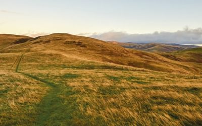
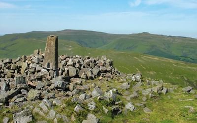
The Cleveland Way was the second national trail to be established in Britain (the Pennine Way was first) and it was officially opened in 1969. The route was devised as a loop around the North York Moors National Park, starting from Helmsley and taking in the steep scarp slope overlooking the plains in the west, all the way to Guisborough, before hugging the cliff coast from Saltburn to Filey to the east.
How long is the Cleveland Way?
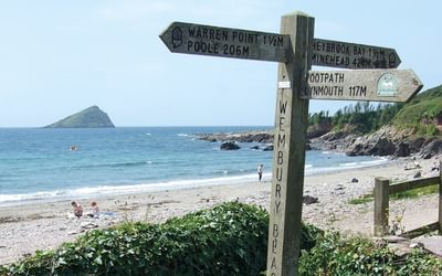
The Cleveland Way wraps its way around the national park covering 117km (110 miles) from Helmsley to Saltburn and down the coast to Filey. Also starting from Helmsley and ending near Scarborough is the Tabular Hills Walk - a dinky (50 mile) shortcut to the coast. At Filey, you could also continue along the Yorkshire Wolds Way to Hull which would add another 80 miles.
Each of the three routes is described in the guidebook, and walkers can complete them separately or link all three trails end-to-end in a long-distance walk of over 400km (250 miles). The whole distance could be completed comfortably within three weeks, even allowing for outward travel and return home. Together the three trails open up a wonderfully rich and varied landscape of cultivated countryside, intricate networks of dales, wild heather moorlands and a dramatic cliff coastline, peppered with dozens of interesting little towns and villages.

The Cleveland Way and the Yorkshire Wolds Way
NATIONAL TRAILS: The North York Moors, Yorkshire Wolds and Yorkshire Coast
£17.95
A walking guidebook to the Cleveland Way and Yorkshire Wolds Way National Trails, plus the Tabular Hills Walk. Crossing the North York Moors National Park, coastal scenery and quiet countryside, the three routes can be joined to create an easy circular route of over 250 miles (400km). Includes an OS 1:25K map booklet of the Cleveland Way.
More informationWhere to stay?
There are specific accommodation lists for the Cleveland Way and Yorkshire Wolds Way, listing plenty of hotels, guesthouses, bed-and-breakfasts, youth hostels, camping barns and campsites that might easily be overlooked, especially if they lie a little off-route. However, bear in mind that accommodation inland tends to be rather limited in some places. These accommodation lists do not carry full details of the hundreds of addresses that are available in the popular resorts, but contact the tourist information centres, who can offer suggestions. Finding somewhere to stay along the Tabular Hills Walk needs careful thought, as places are unevenly spaced and some of the villages have no accommodation to offer.
When is the best time to walk it?
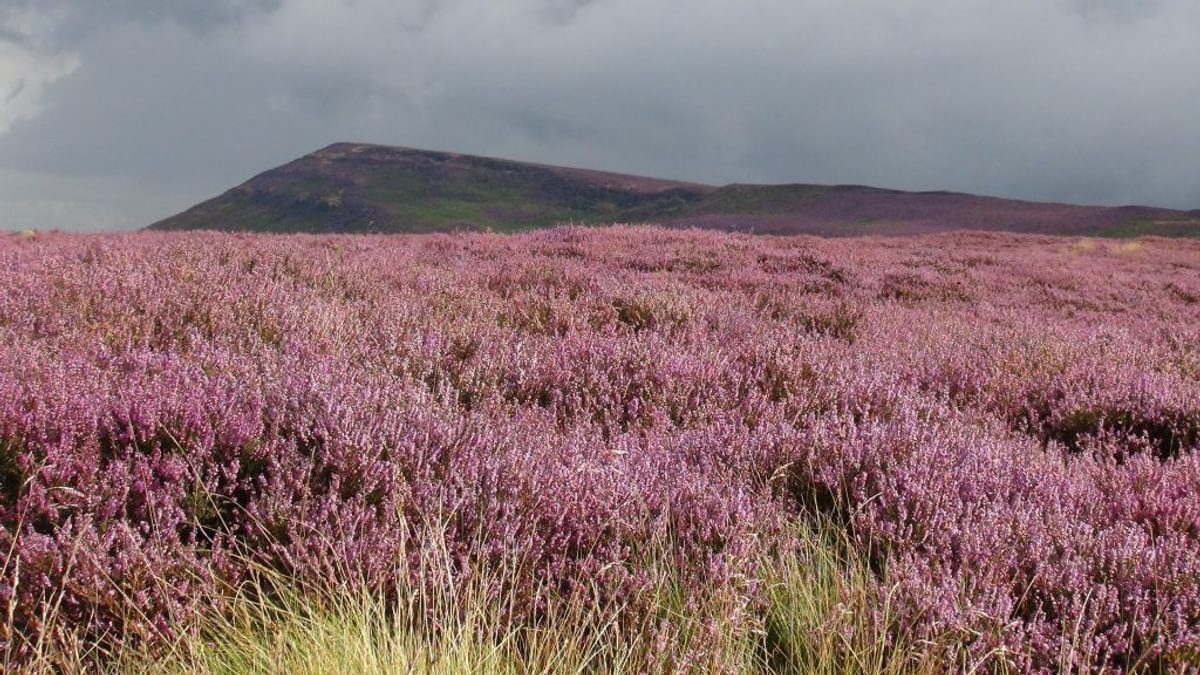
Many walkers probably have an image of the North York Moors that includes purple heather under a blue sky. Such conditions may appear in summer, but bear in mind that the plateau-like nature of the area and its proximity to the sea ensure that misty days are common enough throughout the year. The Yorkshire Wolds, by contrast, feature ploughed fields, green crops and, in early summer, brilliant yellow fields of oilseed rape. Spring can be a wonderful time to walk these routes, when wild flowers are bursting forth and the weather improves day by day, but most walkers opt for the long, bright days of summer. The autumn months can be good, too, with russet hues stealing through the woods and across the bracken slopes.
Winter is for the hardiest of walkers and even the gentle Yorkshire Wolds can be swept by piercingly cold winds. On the higher North York Moors, snow can form drifts that hamper progress just as much as the short daylight hours, and paths along the cliff coast may be dangerous when strong, blustery winds are blowing. A wet winter quickly turns some parts very muddy, although for most of the time the trails follow reasonably firm, dry surfaces that can be used in comfort most of the time. Badly eroded stretches, particularly along the Cleveland Way, were repaired and resurfaced many years ago and now provide a firm footing.
| Stage no | Stage | Stage distance km (miles) | Stage time |
| The Yorkshire Wolds Way National Trail | |||
| 1 | Hessle to South Cave | 21.5 (13½) | 6hr 30min |
| 2 | South Cave to Goodmanham | 18.5 (11½) | 5hr 45min or 6hr |
| 3 | Goodmanham to Millington | 15 (9¼) | 4hr 45min |
| 4 | Millington to Thixendale | 19.5 (12) | 6hr |
| 5 | Thixendale to Sherburn | 30.5 (19) | 9hr |
| 6 | Sherburn to Filey | 24 (15) | 7hr 30min or 8hr |
| Total distance | 129 (80¼) | ||
| 7 | Filey to Scalby Mills (via the Cleveland Way) | 18.5 (11½) | 5hr 30min |
| The Tabular Hills Walk | |||
| 1 | Scalby Mills to Levisham | 33.5 (21) | 10hr |
| 2 | Levisham to Hutton-le-Hole | 24.5 (15¼) | 7hr 30min |
| 3 | Hutton-le-Hole to Helmsley | 22 (13½) | 6hr 30min |
| Total distance | 80 (49¾) | ||
| The Cleveland Way National Trail | |||
| 1 | Helmsley to Sutton Bank | 17 (10½) | 5hr |
| 2 | Sutton Bank to Osmotherley | 19 (11¾) | 6hr |
| 3 | Osmotherley to Clay Bank | 17.5 (11) | 5hr 15min |
| 4 | Clay Bank to Kildale | 15 (9½) | 5hr |
| 5 | Kildale to Saltburn-by-the-Sea | 24 (15) | 7hr 30min |
| 6 | Saltburn-by-the-Sea to Sandsend | 27.5 (17) | 8hr 30min |
| 7 | Sandsend to Robin Hood’s Bay | 16.5 (10¼) | 5hr |
| 8 | Robin Hood’s Bay to Scarborough | 22 (13¾) | 6hr 30min |
| 9 | Scarborough to Filey | 18 (11) | 5hr 15min |
| Total distance | 177 (110) | ||
| Total for all three trails | 404.5 (251½) | ||

The National Trails
19 Long-Distance Routes through England, Scotland and Wales
£18.95
This inspirational guidebook details the UK's 19 National Trails, offering stage by stage overviews for each route including the popular South West Coast Path, Hadrian's Wall Path, Pennine Way, West Highland Way, Cotswold Way, Offa's Dyke Path, South Downs Way, Southern Upland Way and many others.
More information- British long distance walks
- National Trails
- North East England, Yorkshire Dales and Pennines
- About an area
- An intro to
To read more articles like this get our newsletter
Sign up for 20% off your next purchase and to be the first to hear about exclusive competitions, special offers, and news from Cicerone.